Since 2011, the management body of the Biosphere Reserve has been integrated into the Provincial Council of Lugo (as a special administrative body without its own legal personality), made up of a Governing Body (governing body) and a Management Body. Participation (advisory in nature).
OS ANCARES LUCENSES
BIOSPHERE RESERVE
BIOSPHERE RESERVE MANAGEMENT
MANAGEMENT BODIES
Regulations of the management body (BOP Lugo nº 76 – 04.04.2011)
GOVERNING BODY
Composition (19/06/2024)
Meeting agendas
PARTICIPATION BODY
Composition (16/12/2025)
Meeting agendas
Santa María fort in Cervantes
Doiras castle
MANAGEMENT PLAN
The Plan outlines the strategic lines of action aimed at conserving the natural heritage of the Reserve, providing services and infrastructure to residents in order to improve their quality of life and generating wealth and employment to establish population in the territory of the Reserve.
Management Plan for the Os Ancares Lucenses Biosphere Reserve 2024-2034
Final approval Management Plan for the Os Ancares Lucenses BR 2024-2034 (BOP nº 155 05-07-2024)
ANNUAL PERFORMANCE REPORTS
Agüeira Forest
ZONING
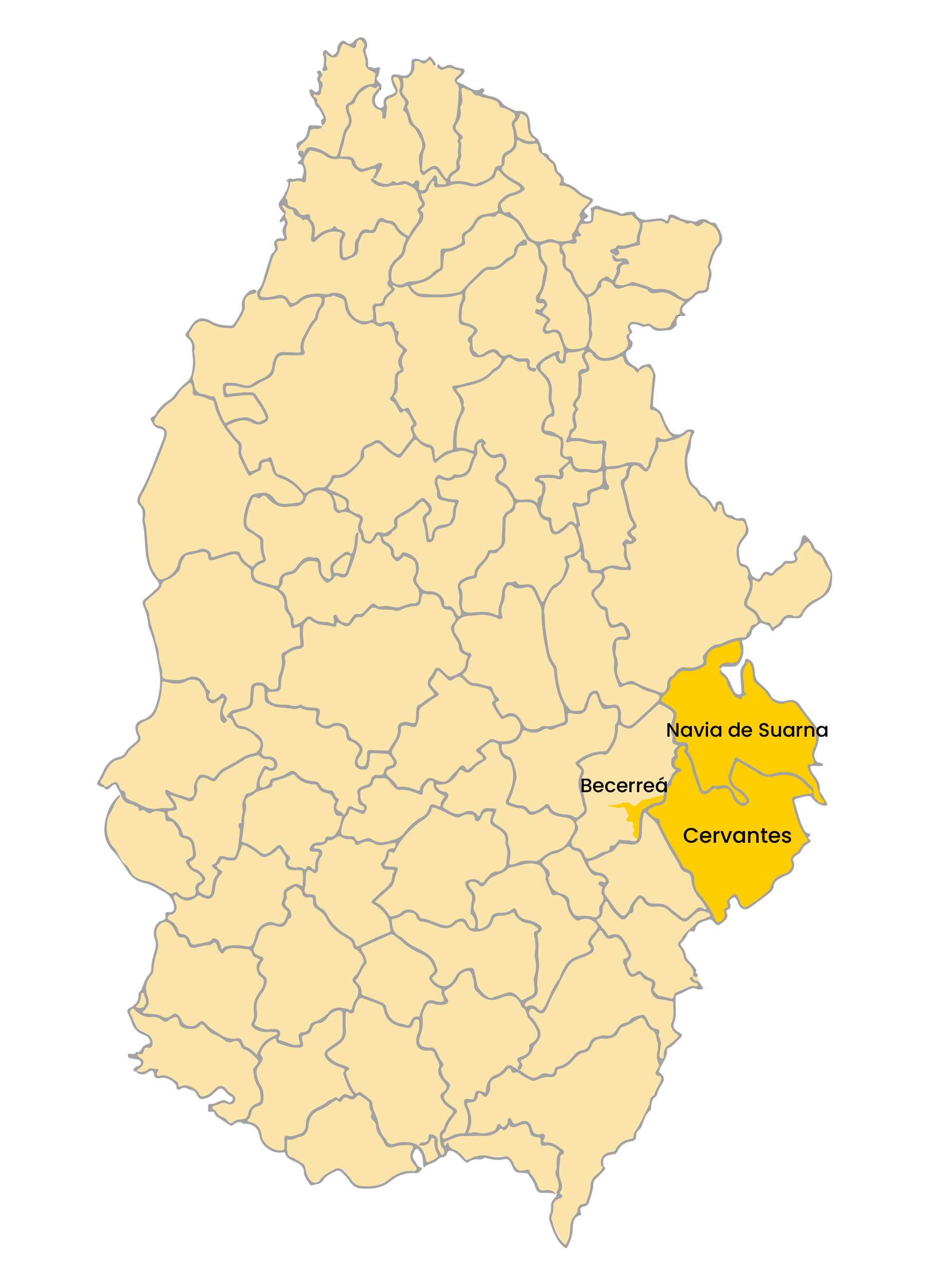
The Os Ancares Lucenses Biosphere Reserve has an area of 53,664 hectares and includes the municipalities of Cervantes, Navia de Suarna and Becerreá.
CORE AREA
It integrates the most important areas for the conservation of the territory’s biodiversity, consisting mainly of the protected natural spaces Ancares-Courel and ZEC Cruzul-Agüeira. It also includes the Brown Bear Protection Zone.
It occupies an area of 14,224 hectares, 26% of the Reserve.
The core area is represented in orange
BUFFER AREA
They are areas of lower conservation value than the core, but in which it is necessary to preserve the configuration of the landscape components, as well as the territorial distribution of the large types of natural and semi-natural habitats.
It covers an area of 31,975 hectares, which represents 60% of the total area of the Reserve.
The buffer area is represented in green
TRANSITION ZONE
They cover areas of high agricultural and livestock productivity in which practically the entire population living in the Reserve is concentrated. It is a rural landscape made up of a mosaic of semi-natural mountain meadows, delimited by tree and bush sebes, along with soutos (forests) spread across the valleys that structure the territory.
It includes an area of 7,465 hectares, which represents 14% of the Reserve.
The transition area is represented in yellow
Preliminary zoning viewer. (You can download the cartography of the limits and zoning of the Biosphere Reserve in the DOCUMENTATION section)
MUNICIPALITIES

Map of the province of Lugo


This work was fully financed by the Next Generation funds of the European Union through the subsidy called by the Xunta de Galicia “Aid for actions by the management bodies of the biosphere reserves of Galicia under the Recovery Plan , Transformation and Resilience, financed by the European Union-NextGenerationEU, for the years 2022 and 2023.” However, the views and opinions expressed are solely those of the author(s) and do not necessarily reflect those of the European Union or the European Commission. Neither the European Union nor the European Commission is responsible for them.
